CONTENTS

List of Walks (see below)

Introduction

Index of place names and features of interest

Walks listed by length

pgtwHainault 016

List of Walks:
Just click on any walk listed below to get the full details; starting and finishing tube stations are shown on the right:-

  1. Trent Park taster (under a mile): Oakwood – Cockfosters
  2. New River links old parks (2½ miles): Manor House
  3. Get Lost in Hadley Woods! (6½ miles): Cockfosters
  4. Parkland Walk – London’s longest nature reserve (5½ miles): Finsbury Park – Wood Green
  5. To Highgate via virgin footpaths (3½ miles): Turnpike Lane  – Highgate
  6. The only way is Essex! (5 miles): Debden – Theydon Bois
  7. From Turnpike Lane through woods and parks to East Finchley (4 miles): Turnpike Lane – East Finchley
  8. The Chess Valley Walk (9¾ miles): Chesham – Rickmansworth
  9. Along Pymme’s Brook’s waterside path (2½ miles): Arnos Grove – Oakwood
  10. Down the Lea from Tottenham Hale to Tower Hamlets (6½ miles): Tottenham Hale – Bow Road
  11. Through the Chilterns from Chesham to Cholesbury (13 miles): Chesham
  12. Looking for Larks in Enfield Chase (9 miles): Cockfosters
  13. Across Essex’s quiet fields to Hainault Forest Country Park (5 miles) Grange Hill – Hainault
  14. Golders Green to Hampstead Heath (6 miles) Golders Green
  15. To Hertford Town by the towpath from Tottenham (20½ miles) Tottenham Hale
  16. Chilterns hill tops and valley bottoms (10½ miles) Amersham
  17. Bois and girls come out to play (10 miles) Buckhurst Hill – Theydon Bois
  18. Along towpaths from Regents Park to Kings Cross (4 miles) Regents Park – Kings Cross
  19. Richmond Park and Wimbledon Common (6½ miles) Richmond – Southfields
  20. Heathrow to Iver, Bucks via the Colne Valley Way (12 miles) Terminal 4 – Iver station, Bucks
  21. The Little Lakes of Leyton Flats (2-3 miles) Snaresbrook
  22. Wandering in Wanstead ( 5 miles) Redbridge – Manor Park
  23. From Little Venice via Wormwood Scrubs to Alperton (7 miles) Warwick Avenue – Alperton
  24. Walking to Wendover via the Chiltern Link path from Chesham (9 miles) Chesham – Wendover
  25. A walk in the woods from Snaresbrook to Chingford (5 miles) Snaresbrook – Chingford
  26. Wimbledon to Richmond via the centre of the deer park (6½ miles) Wimbledon – Richmond
  27. Rambling to Rickmansworth along country lanes and canal banks (8¾miles) Chorleywood – Rickmansworth
  28. Two Rivers and One Canal (10 miles) Richmond – Hanger Lane
  29. By woodland and waterway from Moor Park to Uxbridge (10¼ miles) Moor Park – Uxbridge
  30. Head to Harrow for a Walk on the Wildside (7 miles) Stanmore – Headstone Lane
  31. A walk in the parks, the capital’s greenest bits (6miles) Lancaster Gate
  32. Moor Park, Oxhey Woods, Hatch End (4½ miles) Moor Park – Hatch End
  33. To Hundred Aker Wood with Winnie the Pooh (4½ miles) Stanmore – Elstree
  34. Following the boatrace from Putney to Mortlake (6 miles) Putney Bridge – Kew Bridge
  35. Bird-watching in Essex (8.5 miles) Epping
  36. Walking away from Watford (7¾ miles) Watford
  37. Beverley Brook and Caesar’s Camp (8 miles) Putney Bridge – Wimbledon
  38. Dollis Valley Greenwalk (Southern half) (5 miles) Golders Green – Woodside Park
  39. Boudicca’s Battleground (6 miles) Theydon Bois
  40. Up the river to Hampton Court Palace (7 miles) Richmond – Hampton Court
  41. The wonderful wetlands of the Ingrebourne Valley and Rainham marshes (8½ miles) Upminster Bridge – Purfleet
  42. Green Chain Walk from Greenwich to Falconwood (7 miles) North Greenwich – Falconwood
  43. Dollis Valley Greenwalk (Northern Half) (5 miles) Woodside Park – Moat Mount
  44. Go with the Flow: Down the Thames from Richmond 2Q (3½ miles) Richmond – Kew Bridge
  45. Upstream from Upminster (4½ miles) Upminster Bridge – Harold Wood
  46. Via GUC towpath from Horsenden Hill to Bulls Bridge (8 miles) Alperton – Hayes & Harlington
  47. Follow Folly Brook by Darlands lake to Totteridge Village (3 miles) Woodside Park – Totteridge and Whetstone
  48. From Burtonhole to the Northern Heights: Barnet revisited (4 miles) Woodside Park – Totteridge & Whetstone
  49. Beam Parklands: the green heart of Dagenham (5 miles) –  Dagenham East
  50. Roaming along the Rom (3½ miles) Dagenham East
  51. Chilling out in the Chilterns: (7½ miles) Chesham – Tring
  52. Islington’s hidden nature reserve: (½mile) Arsenal – Finsbury Park
  53. Dog-free in Walthamstow Wetlands: (2½ miles) Tottenham Hale
  54. Along The Essex Way to Toot Hill and Greensted-juxta-Ongar: (7 miles) Epping
  55. Come along Ducks, let’s waddle around Woodberry Wetlands (1¾ miles) Manor House
  56. Let’s visit the vintage orchards of Hospital Hill (3¼ miles) Fairlop
  57. Trent Park, Camelot Moat and Merryhills Way (4 miles) Cockfosters – Oakwood
  58. 35 floors up – the highest green walk in London (<½ mile) Monument
  59. Thames Path, Greenwich Park and Blackheath (5 miles) Greenwich North — Lewisham
  60. Follow the Greenway from Fish Island to Beckton (5½ miles) Hackney Wick – Plaistow
  61. Exploring the Crane Valley: the gunpowder plod (10 miles) Richmond – Hayes & Harlington
  62. Let’s wend our way to the Welsh Harp (4 miles) Preston Road – Golders Green
  63. It’s two tings on the towpath beside the backwaters of Bow ( 10 miles) Abbey Road – Hackney Wick
  64. Walk a mile in Mile End park (2¾ miles) Mile End – Hackney Wick
  65. Exploring the Olympic games’ green legacy (3 miles) Hackney Wick
  66. The green oasis inside the Barbican (less than one mile) Barbican
  67. The wick-ed alternative route along the Lee Valley (5½ miles) Hackney Wick – Tottenham Hale
    Where to now? Covid-19 and plans for 2020 and beyond
  68. A fairway to walk in Mill Hill (3 miles) Mill Hill East

INTRODUCTION

A very warm welcome to “Peter’s Green Tube Walks”.

The aim of this site is to help you to:

Use the London Underground railway network (i.e. the ‘tube’) as a gateway to the English countryside

Explore footpaths and little-known byways where you may find fresh air, bird song and sunshine

Walk for your health and happiness. The countryside is the best place to de-stress after a hard day in the city

Let veteran hiker Peter Turner be your guide. Each walk is outlined by easy-to-follow instructions, and has been assessed for health and safety aspects as well as its suitability for people with reduced mobility

These walks are suitable for residents of London and visitors alike

All the routes I describe are on public rights of way, I don’t endorse walking on private property

No boots, maps or compasses are required on any of these walks, just a bag for your lunch and a drink (and a print-out of the instructions for the walk you have chosen.)

I hope you enjoy these walks as much as I did.

Peter Turner.

056

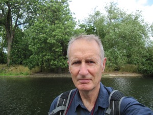
Hi, I’m Peter Turner and here are some more details about this blog and how it works. I’ve written “Peter’s Green Tube Walks” because I want to share my knowledge of London’s green spaces with you. (That’s a selfie I took in Regents Park on one of the walks.)
Ever since I was a kid I have liked walking in the countryside, either with family and friends or on my own. I enjoy the exercise, the birdsong and the sun on my face.
London is a superb base for exploring the countryside because of its excellent transport network. As a pensioner I find that it is also very cheap – with a senior rail card and a Freedom Pass I can get from North London to the North Downs for less than a cup of coffee.
I have limited this footpath guide to those paths accessible by tube, and there are literally dozens of them which I hope to visit and describe over the next couple of years.

It all started when a friend said to me “Why don’t you write a book of walks so other people can visit all the places you know?”

Well, a book of walks, or a blog in this case, needs a unique selling point, like it stops at pubs or tea shops on the way. I have two u.s.p.’s.
(1) Every walk starts and ends at a tube station. (For those of you living on Mars that means a station on the London Underground network!)
Occasionally a walk finishes at an overground station or a bus stop, but clear directions are given as to how to return to the nearest tube station.
(2) Every walk takes the needs of the less mobile into account. By that I mean a spectrum from reasonably fit pensioners like me to people in wheel chairs and babies in push-chairs/baby buggies.

This doesn’t mean the walks are not suitable for fit young people too.

tubewqlks 163

Each walk has the following features included in its description to make it clear what’s involved, and to facilitate access:

Time it takes to walk the walk. It’ll probably take less in practice because I timed it while stopping to take photos, look at the map and write notes.

Distances are shown in miles and kilometres.

Pedometer reading. Some people use a step counter or pedometer to set themselves fitness targets like “I will walk 10,000 steps a day”. This is for their benefit. Of course my pace may not be the same length as yours, so don’t expect your final total to be identical, this is just to give you a rough idea.

[Downhills Park walking route, Haringey]

Refreshments. I carry my own: it’s cheaper; but if you do want to graze your way round the green belt, then this guide will help you do it!

tubewqlks 165

Access: I hope this helps if you’re not very mobile, for whatever reason. I have not personally pushed either a wheel chair or a push chair round any of these walks, but have made a fairly good estimate, I hope, of potential problems. No way can a wheel chair get through a kissing gate or over a stile. You don’t have to be in one to realise that!

[Olympic Park]

Toilets get more necessary as you get older… Using the bushes is all very well, but many of these walks are within sight of houses and roads at times. So I’ve mentioned all the WCs I found en route.

Surface doesn’t matter so much if you’ve got a comfortable pair of waterproof shoes on. (I get mine in T.K.Maxx clearance section for around £30 a pair). There are no crags or screes near to tube stations, unfortunately! So there’s no need for leather mountaineering boots. After rain the ground gets slippery, so whether it is mentioned in the individual walk page or not, play safe and take a stick. I use one of those collapsible ‘trekking poles’ that fits in my rucksack when I don’t need it.

Gradient. There are some steep bits. If they’re likely to be a problem for you, read the text of the walk first and if it sounds a bit tough choose a different flatter walk instead. Always check with your GP before undertaking unaccustomed exercise. If you’ve been given the green light, start with short walks first and build up to the longer ones later.

Benches can provide a welcome break. Somewhere to sit while you have your sandwiches. I never do even a short walk without a few breaks along the way. You get less tired that way.

Maps. I decided not to put maps or compass bearings in this blog. Get them on your mobile or tablet if you want them. The hope is that my written directions are so crystal clear and unambiguous that it would never occur to you to get a map out even if you had one in your pocket! Tell me I’m right! (When writing this blog I used a street map atlas that covers all of outer London, and Ordnance Survey Explorer maps with a scale of 1:25,000, that’s about 2½  inches to a mile – perfect!)

Buy on line (waterproofed versions are available) at Stanfords.co.uk, or from Stanfords’ map shop just off Long Lane in Covent Garden. Their new address is 7 Mercer Walk, Covent Garden, London, WC2H 9FA, tel 020 7836 1321.  They cost £8.99 each (October 2017 prices) and the following sheets will cover every path in this blog:
160 Windsor and Weybridge
161 London South
162 Greenwich and Gravesend
172 Chiltern Hills East
173 London North
174 Epping Forest and Lee Valley
175 Southend-on-Sea Basildon
181 Chiltern Hills North
182 St Albans & Hatfield
183 Chelmsford and The Rodings
(Total cost £89.90)

Gear. Nothing special is needed. Be sensible. I don’t need to tell you not to wear high heels. Wellies always chafe my feet, but some people love them. Being England, the weather can change, so bring a waterproof top and even rubber leggings. Put them in a small rucker with your sandwiches and water and mobile phone.

Volunteering. Where I have found them, I’ve given contact details for various local bodies who do voluntary maintenance work on the paths.

Liability. I have done risk assessments on these walks and have concluded they are all reasonably safe. Wear appropriate clothing, take some food and water with you as well as a mobile, and be careful not to trip over tree roots or slip in the mud.  Tell someone where you have gone and what time you expect to arrive back home. It is recommended you take a map with you. Don’t bite off more than you can chew – start with short walks first before attempting a long one. If you are not fit, check with your GP before attempting unaccustomed exercise. I accept no liability of any kind – you undertake these rambles entirely at your own risk.

Proofreaders wanted. If you use one of these walk guides, please e-mail me and tell me if the directions were clear, and if they were weren’t I want to know too. My friend Geoff told me my directions for the Parkland Walk were not detailed enough in one place, so I’ve beefed that section up. Your help will be acknowledged in the form of a brief mention at the end of the relevant page. (like “Checked by Geoff, North London”). Unless you specify otherwise.

Water and Ice. The Lee Valley Park authorities issue the following advice which probably applies to all rivers lakes and ponds in the area covered by this blog:
“For your own safety we strongly advise against swimming. There are risks associated with using these waters:
Pollution: may contain traces of sewage, chemicals, heavy metals and oil;
Leptospirosis: through contact with urine;
Sharp objects:
Strong currents and deep water:
Cold water: 
hypothermia and cold shock.”
To which I would add ‘beware crumbly and slippery banks’, and ‘never walk or jump on ice.’
The Environment Agency request that we report ‘pollution incidents’ to them on 0800 80 70 60.

Finally, feel free to write in with any other comments and criticisms. This is an evolving work, and the more inputs there are the more useful it might turn out to be.

Find the paths and places less travelled.

I feel that everyone deserves a place to escape to; then we’ll all be getting more fresh air, exercise and sunshine. That is, after all, the ultimate aim of this blog.

See you out there!

Peter Turner.

peterturner1942@yahoo.co.uk

tubewqlks 164

WALKS LISTED BY LENGTH

pgtwHainault 007

Under 1 mile
(1) Trent Park taster
(52) Islington’s hidden nature reserve
(58) 35 floors up – the highest green walk in London
1 – 2 miles
(53) Dog-free in Walthamstow Wetlands (Northern part)
(53) Dog-free in Walthamstow Wetlands (Southern part)
(55) Come along Ducks, let’s waddle round Woodberry Wetlands
2 – 3 miles
(9) Along Pymme’s Brook waterside path
(2) New River links old parks
(21) The Little Lakes of Leyton Flats
(47) Follow Folly Brook by Darlands Lake to Totteridge Village
(53) Dog-free in Walthamstow Wetlands (both Northern and Southern parts)
(64) Walk a mile in Mile End Park
3 – 4 miles
(7) From Turnpike Lane through woods and parks to East Finchley
(5) To Highgate via virgin footpaths
(44) Go with the flow: Down the Thames from Richmond 2Q
(50) Roaming along the Rom
(56) Let’s visit the vintage orchard of Hospital Hill
(65) Exploring the Olympic Games’ green legacy
(68) A fairway to walk in Mill Hill 
4 – 5 miles
(18) Along towpaths from regents Park to Kings Cross
(6) The only way is Essex!
(22) Wandering through Wanstead
(25) A walk in the woods from Snaresbrook to Chingford
(32) Moor Park, Oxhey Woods, Hatch End
(45) Upstream from Upminster
(48) From Burtonhole to the Northern Heights: Barnet revisited
(49) Beam Parklands: the green heart of Dagenham
(57) Trent Park, Camelot Moat and Merryhills Way
(62) Let’s wend our way to the Welsh Harp
5 – 6 miles
(4) Parkland Walk
(13) Across Essex’s quiet fields to Hainault Forest Country Park
(14) Golders Green to Hampstead Heath
(34) Following the boatrace from Putney to Mortlake
(38) Dollis Valley Greenwalk (Southern Half)
(43) Dollis Valley Greenwalk (Northern half)
(59) Thames Path, Greenwich Park, and Blackheath
(60) Follow the Greenway from Fish Island to Beckton
(67) The wick-ed alternative route along the Lee Valley
6 – 7 miles
(3) Get “lost” in Hadley Woods!
(10) Down the Lea from Tottenham Hale to Tower Hamlets
(19) Richmond Park and Wimbledon Common
(23) From Little Venice via Wormwood Scrubs to Alperton
(26) Wimbledon to Richmond via the centre of the deer park.
(30) Head to Harrow for a Walk on the Wildside
(31) A walk in the park, the capital’s greenest bits
(39) Boudicca’s battleground
7 – 8 miles
(42) Green Chain Walk from Greenwich to Falconwood
(36) Walking away from Watford
(37) Beverley Brook and Caesar’s Camp
(40) Up the river to Hampton Court Palace
(46) Via GUC towpath from Horsendon Hill to Bulls Bridge
(51) Chilling out in the Chilterns: Chesham to Tring
(54) Along The Essex Way to Toot Hill And Greensted-juxta-Ongar
8 – 9 miles
(24) Walking to Wendover via the Chiltern Link path from Chesham
(27) Rambling to Rickmansworth along country lanes and canal banks
(35) Bird watching in Essex
(41) The wonderful wetlands of the Ingrebourne valley and Rainham marshes
9 – 10 miles
(8) The Chess Valley Walk
(12) Looking for Larks in Enfield Chase
(17) Bois and girls come out to play
(28) Two rivers and one canal
(61) Exploring the Crane valley: the gunpowder plod
Over 10 miles
(16) Chilterns hilltops and valley bottoms (10½ miles)
(11) Through the Chilterns from Chesham to Cholesbury (13 miles)
(15) To Hertford Town by towpath from Tottenham (20½ miles)
(20) Heathrow to Iver, Bucks (12 miles)
(29) By woodland and waterway from Moor park to Uxbridge (10¼ miles)
(63) It’s two tings on the towpath by the backwaters of Bow (10 miles) 

pgtwHainault 035

ALPHABETICAL INDEX OF PLACE NAMES AND FEATURES OF INTEREST

pgtwHainault 004

– All stations are all shown in bold type

– Numbers refer to the walks, e.g. no.4 is Parkland Walk.
(For numbered list of walks see Contents page.)

-Click on the number to get the page it is linked to, e.g. if you want to see some deer click on 2 or 4 etc, and a walk with deer comes up.

Abbey Mills Pumping Station 60,
Abbey Road 63,
Abridge 6,
AcelorMittal Orbit 60, 63, 64, 65,
Acid heathlands 3, 19, 59,
Robert Adam 28,
Akeman Road 51,
Albyns Lake 41,
Aldenham country park 33,
Alexandra Palace 4,
Alexandra Park 4, 7,
Allianz Park 68,
Alperton 23, 46
Ambresbury banks 39,
Amersham 16,
Amersham Old Town 16,
Anglers 50,
Animal pens 14, 2,
Ant hills 20, 30,
Apsley marina 36,
Apsley monument 31
Aquadrome 27,
Arcelor Mittal Orbit 60
Arnos Grove
9, 47, 48,
Arsenal 52,
Art installation 56, 60, 63,
Ash dieback disease 45,
Asheridge valley 51,
Sir David Attenborough 37,
Avenue Park 61,
Aviaries 2, 14,
A.V.Roe 53,
Ballast Quay 59,
Ballinger Bottom 24,
Cecil Balmond 60,
Bandstand 18, 59,
Bardag Lake 50,
Barking Creek 60,
Barn Hill 62,
Barnes Bridge 34,
Barnes Common Nature Reserve 37,
Barnet Playing Fields 43,
Dame Henrietta Barnett 38,
Batchworth Lake 27,
Bathing ponds 14,
Battle of Barnet 3,
Battleground re-enactment 39,
Bazalgette, Sir Joseph 34, 37, 60, 63,
Beam engine 67,
Beam River Valley/Country Park/Parklands 49, 50,
Beckton 60,
Bell Common 39,
Bellingdon ridge 51,
Bellows Wood 24,
Belted Galloway cattle 53,
Bentley Priory 30,
Bernardo O’Higgins 26,
Beverley Brook 19, 26, 34, 37,
Beverley Meads Woods 37,
Big Wood 38,
Bird Keepers Cottage 31,
Bird watching 7, 15, 35,
Bishops Wood Country Park 29,
Bitterns 15,
Blackheath & Blackheath Vale 59,
Black Poplars 50,
Blackwall Cut 63,
Blackwall Tunnel 63,
Bluebells 24,
BMX 10,
Boat race 34,
Boating lake 2, 4,
Bomber Command memorial 31,
Queen Boudicca 39,
Bow 63,
Bow Backwaters 60, 63,
Bow Creek 60, 63,
Bow Creek Eco Park 63,
Braunston 36,
Brazil Mills Wood 61,
River Brent 28, 62,
Brent Lodge park 28,
Brent Reservoir 62,
Brent River Park walk 28,
Bridgewater monument 51,
Bromley-by-Bow 10,
Brook Farm Open Space 43,
‘Capability’ Brown 28, 57,
Broxbourne 15,
Brunel 28,
Brunswick Park Waterfall Walk 9,
Buckhurst Hill 17,
Buckingham Palace 31,
Bull Rush 50,
Bulls Bridge 46, 61,
Burtonhole Farm/Lane 48,
Bury Lake 27,
Butlers Retreat 25,
Butterflies 29, 35, 62,
Butterfly house 14,
Butterfly meadows 1, 57,
Buzzards 30, 51,
Cable cars 59,
Caesar’s Camp Fort 26, 37,
Caesar’s ponds 33,
Camden Lock 18,
Camelot Moat 57,
Camley Road Nature Reserve 18,
Canal 18,
Canary Wharf 59, 63,
Capital Ring 19, 26, 28, 42, 46, 60, 62,
Captain’s Wood nature reserve 51,
Carp 50,
Carr 42,
“The case is altered” Inn 30,
Cassiobury Park 36,
Cattle grids 25,
Causeway Watermeadows 61,
Ceps 29,
Chalara 45,
Chalk stream 8, 16,
Channelsea 60, 63,
Charlton 42,
Charlton Park 42,
Chase Nature Reserve 49, 50,
Chase Water 50,
Cherry Tree Woods 7,
Chesham 8, 11, 24, 51,
Chess Valley Walk 8,
Chigwell Church 13, 
Chigwell Row Local Nature Reserve 13,
Chiltern Hills 8, 11, 24, 51,
Chilterns A.O.N.B. 27,
Chiltern Link path 24,
Chingford 25,
Chingford Plain 17, 25,
Chipping Ongar 54,
Chiswick Bridge 34,
Cholesbury Camp 11,
Chorleywood 27,
Church, old 54,
Cient lands 15,
Cinnabar moth 50,
City Island 63,
City of London 58,
City Mills River 60, 65,
Clapboard 13, 35, 54,
Claybury hall 56,
Claybury park 56,
Clissold Park 2,
Clive of India 31,
Clock Mill 63,
Coal post 29,
Cobbins Brook 35,
Cockfosters 13, 12, 57,
Cody Dock 63,
Coldharbour (street) 63,
Coldharbour point 41,
Cole Park 61,
Colnbrook 20,
Colne Valley 27,
Colne Valley Way/Walk 20,
Commander Lightoller 28,
Community orchard 49,
Concrete barge graveyard 41,
Connaught water 17,
Conservation Volunteers 61,
Coopersale 54,
Copper Box 65,
Coppermill Tower 53,
Coppicing 19,
Copt Hall 35,
Copthall playing fields 68,
Court Leet 20,
Cowslips 24, 35,
Coy Carp Inn 27, 29,
Cranebank 61,
Crane Park Island 61,
Crane River Valley 61,
Cranford Park 61,
Crews Hill 12,
Croom Hill gate 59,
Crouch End Open Spaces 5,
Crouch Hill Park 4,
Cutty Sark 63,
Cutty Sark pub 59,
Dagenham 49,
Dagenham Corridor 50,
Dagenham East 49, 50,
Darlands Lake 47, 48,
Dartford bridge 41,
Debden 6,
Debden Green 39,
Deckchairs 31,
Deer 2, 4, 15,17, 19, 26, 30, 37, 39, 59,
Denham 29,
Diamond bridge 65,
Diana Princess of Wales Memorial Fountain 31,
Dinosaur sculptures 14,
Disused railway line 4, 68,
Docklands Light Railway (DLR) 59,
Dog-free walks 53,
Dollis Valley/Brook/Hill 38, 43, 47, 48,
Domesday Book 4,
Donkey Wood 61,
Dracula 41,
Ducketts Common 5,
Duckpond 48,
Dukes Hollow Nature Reserve 34,
Eagle Pond 21, 25,
Ealing Broadway 28, 61,
Earthworks 4, 11, 39, 51,
East Barnet Village 9,
East India Dock Basin 63,
Eastbrookend Country Park 49, 50,
East Finchley 7,
Ecology centre (Islington) 52,
Ecology Park (Greenwich) 42,
Eel Pie Island 40,
Elstree 33,
Enfield Chase 12,
Engine House (Walthamstow Wetlands) 53,
Epping 35, 54,
Epping Forest 17, 21, 25, 39,
Epping Long Green 35,
Epping Thicks 39,
Essex 6,17, 35, 54,
The Essex Way 54,
Estuary 41,
Fairlop 56,
Fairway 68,
Falconwood 42,
20 Fenchurch Street  58,
Fens 41,
Filter beds 10, 67,
Finsbury Park 4, 52, 55,
Finsbury Park 2, 4,
Fish Island 60, 65,
Fishers Green 15,
The Fishery 33,
Fitzherbert walk 28,
Flint 16, 24,
Flood control 49,
Folly Brook 47, 48,
Footballer caterpillars 50,
Forest Gate pub 35,
Forest Way 35,
Forestry Commission 45,
Forman’s Salmon Smokehouse 60,
Friends bridge 67,
Frog pool 7,
Fryent Country Park 62,
Fungi 17, 54,
Furze heath 30,
River Gade 36,
Gernon Bushes 54,
Giant Hogweed 47, 48,
W.S.Gilbert 30,
Gillespie, landscape architect 58,
Gillespie Road Park and Local Nature Reserve, Islington 52,
Gipsy tombstone 25,
Goat-man 4,
Golders Green 14, 38,
Golders Hill Park 14,
Golf 59, 68,
Gormley, Anthony 42, 
Gotfords Hill 62,
Graffiti 10, 18, 60, 65,
Granary Square 18,
Grand Union Canal 18, 23, 27, 28, 29, 36, 46, 51, 61, 62,
Grange Hill 13,
Grass snake 54,
Gravel pits 27,
Graveyard (disused) 5,
Grazing rights 25
Great British garden 65,
Great Western Railway 28,
Green belt 48,
Green bridge 64,
Green Chain Walk 42,
Green Park 31,
Greenford Broadway 28,
Greensted-juxta-Ongar 54,
Greenway 60,
Greenway Orchard 60,
Greenways 5, 7,
Greenwich North Station 5942,
Greenwich Park 59,
Greenwich Peninsula 42, 59, 63,
Grim’s Ditch 30,
Grim’s Dyke 30,
Gunpowder magazine 41, 61,
Gym, outdoor 56,
Hackney marshes 10, 65, 67,
Hackney Wick 60, 63, 64, 65, 67,
Hackney Wick Community Woodland 10, 67,
Hadley Common 3,
Hadley Highstone 3,
Hadley Manor Open Space 3,
Hadley Road 57,
Hainault 13,
Hainault Forest Country Park 13,
Hampden pond 24,
Hampstead Garden Suburb 38,
Hampstead Heath 14,
Hampstead Heath Extension 38,
Hampstead Ponds14,
Hampton Court 40,
Hampton Court Palace 40,
Hanger Lane 28,
Hanwell locks 28,
Harlington & Hayes town 46,
Harold Court Wood 45,
Harold Wood station 45,
Harrow 30,
Harrow on the Hill 32,
Harrow Weald Common 30,
Hatch End 32,
Havering Ingrebourne Way 41, 45,
Hawridge 11, 51,
Hay 43,
Hayes & Harlington station 46, 61,
Hayfields 28,
Hazards 61,
Headstone Lane 30,
Heathland 19,
Heathrow 20,
Hedge corridors 64,
Hemel Hempstead 36,
King Henry VIII 40,
Herberts Hole 24,
Herons  28,
Hertford 15,
Hertford Union canal 64, 65.
Hides 67,
Highams park lake 25,
High Beach/Beech 17,
Highgate 5,
Highgate Ponds 14,
Highgate Woods 4, 7,
Highwaymen 42, 59,
Highwood Hill 47,
Hillingdon Trail 29, 61,
Holecombe Dale 47,
Hollow Pond 21,
Holmer Green 16,
Honeysuckle 27,
Hooks Hall Lake 50,
Hornchurch Country Park 41,
Hornfair Park 42,
Hornsey Church tower 5,
Hornsey Water Works 7,
Horsendon Hill 46,
Horses 57,
Horse-drawn barges 64,
Horseshoe bridge 67,
Horton 20,
Hospital Hill 56,
‘Hotlips’ bridge 67,
Hounslow Heath 61,
House boats 23,
House Mill 63,
HS2 23,
Hugh Myddleton 7,
Gary Hume 59,
Hundred Aker Wood 33,
Hyde Park 31,
Hyde Park Corner 31,
Ingrebourne Marshes, River, Valley, Way, 41, 45,
Iron Bridge 60,
Isabella Plantation 26,
Island gardens 63,
Isle of Dogs 59, 63,
Isleworth 28, 44,
Isleworth Ait 28,
Italian Gardens 31,
Iver 20,
Ivinghoe beacon 51,
Ivy Chimneys 39,
Jack’s Hill 39,
Jack’s pond 3,
Jack Straws Castle 14,
Japanese Water Garden 57,
Jenner, Edward 31,
Jessop, William 28,
Jubilee Greenway 60, 63,
King James I 37,
Sir Anish Kapoor 60,
Kestrels 28,
Kew Gardens 44,
Kensal Rise cemetery 23,
Kensington Gardens 31,
Kensington Palace 31,
Kenwood House 14,
Kew Bridge Station 34, 44,
King, Stephen 4,
Kings Cross Station 18,
King’s Observatory 44,  
Kingston upon Thames 40,
Kitchen garden 14,
Kites 14, 51,
Kneller Gardens 61,
Kosher food 38,
Lake 12, 13, 41, 57,
Lammas land 15,
Lancaster Gate 31,
Landfill 41,
Landscape architecture 58,
Latimer House 8,
Latimer Village Green 8,
Leamouth 63,
LeaWay South 63,
Lee Valley Regional Park 15, 10, 53, 67,
Leg O’ Mutton reservoir 34,
Levée 49,
Lewisham DLR station 59,
Leyton Flats 21,
Lighthouse 59, 63,
Lime trees 57,
Limehouse Basin 63,
Limehouse Cut 63,
Lippitts  Hill 17,
Little Venice 23,
Little Wood 38,
Llamas 11, 51,
Lock gates 10, 27, 28, 36,
Lodge Farm 35,
The Log Cabin 21,
Log Church 54,
London Apprentice inn 28,
London Loop 29, 32, 33, 41, 43, 45, 57, 61,
London marathon 59,
London Museum of Water and Steam 44,
“London View” (Stanmore) 30,
London Walkers Forum 29,
London Wetland Centre 34,
London Zoo 18,
Londonist, blogger 63,
Long boats 23,
Longplayer project 63,
Long Wall Path 60, 63,
Long Water 31,
Lords Bushes 17,
Lowland pastoral landscape 43,
Lowndes Park 24, 51,
Sir Edwyn Lutyens 38,
Lye Green 11,
Edward Bulwer Lytton 32,
Managed wilderness, Islington, 52,
Manor House 2, 55,
Manor Park station 22,
Market 34, 37,
Market Hall 16,
Markfield Park 10, 67,
Marshes 15, 67,
Maryon Park 42,
Maryon-Wilson Park 42,
Matilde, Queen 63,
Meades Water Gardens 8,
Meadow Pippit 23, 
Meanwhile Park 23,
Mereway Nature Park 61,
Prime Meridian 59,
Merryhills Brook 57,
Merryhills Way 57,
Middlesex Filter Beds 10, 67,
Migrating birds 41, 50,
Mile End Park 63, 64,
Mile End station 64,
Mill Hill East station 68,
Mill Hill Old Railway 68,
Millenium Dome 42, 59, 63,
Millennium Wharf 63,
Mill Hill 47, 48,
Millhill Viaduct 38,
Mill Meads 60,
Millwall Docks 63,
John Milton’s house 20,
Misbourne, River 16,
Moat Mount Local Nature Reserve 43,
Model Boating Pond 14,
Monken Hadley Common 3,
Monument 58,
Henry Moore 59,
Moor Mead Park 61,
Moormasters 20
Moor Park 29, 32,
Mortlake 34,
Motte and Bailey 54,
Muntjac 6, 15,
Murals 10,
Narrow Boats 27, 28, 29, 36, 63, 67,
National Maritime Museum 59, 63,
Nature Reserves 24, 5, 52,
Nescafe factory 61,
Nettles 35,
New Malden 37,
New River 2, 5, 7, 55,
New River Path 2, 55,
Jack Nicholson 33,
Nightingales 15,
North Greenwich 42,
North Marsh 53,
North Pole 33,
Northern heights 47, 48,
Northern Outlet Sewage Embankment (NOSE) 60, 63,
Nude sun-bathing 14,
O2 Arena 42, 59, 63,
Oakhill Park 9,
The Oak Trail 39,
Oakwood 1, 9, 57,
Obelisk 12, 57,
Old Deer Park 44, 61,
Old Ford Lock 60,
Old Shire Lane 27,
Olympic Park 10, 60, 65,
Ongar 54,
Orbit, Arcelor Mittal 60, 63, 65,
Orchard, Plaistow 60,
Orchard, vintage 56,
Ostrich Farm 27,
Ostrich Inn 20,
Oxford v. Cambridge boat race 34,
Oxhey Woods Nature Reserve 32,
Oxleas Woods 42
Paddington canal 23,
Paddington station 61,
The Paddock nature reserve 53,
Pages Wood 45,
Palewell Common 37,
Parkland Walk 4, 68,
Parliament Hill 14,
Pavilion cafe 31, 59,
Peasants revolt 59,
Pen Ponds 26,
Peregrine falcon 53,
Peter Pan statue 31,
Petersham Common 26,
Petersham Meadows 26,
Philipshill Wood 27,
Philosophers garden 5,
Pilgrims ferry 41,
Pill box 4935, 41
Pinnerwood House 32,
Pits 59,
Pitshanger park 28,
Plaistow 60,
Plane trees 34,
Planetarium 59,
Plumstead 60,
Pollution levels 34, 61,
Ponds 14,
Preston Road 62,
Primrose Hill 18,
Priory Park 5,
Pubs 17,
Purfleet 41,
Putney Common 19,
Putney Bridge 34, 37,
Pymme’s Brook 9,
Queen Elizabeth Hunting Lodge 17, 25,
Queen Elizabeth II Olympic Park 60, 65,
Queen Matilde 63,
Queens Orchard, Greenwich 59,
Queen’s Wood Local Nature Reserve 5, 7,
Rabbits 11, 35, 49,
Radial lock gates 65,
Railway Fields Nature Reserve 2,
Railway line (disused) 4, 52,
Raingarden
Rainham 41,
Rainham Marshes 41
Ramsar 53
Ramsons 24,
Redbridge 22,
Red Kites 8, 11,
Reed beds 41,
Reed Mace 50,
Regents Canal 18, 63, 64,
Regents Park 18,
Regents Park Mosque 18,
Regents Park Station 18,
Repton, Humphrey 56, 57,
Reservoirs 15, 53, 55,
Richmond 19, 26, 28, 40, 44, 61,
Richmond Bridge 28,
Richmond Deer Park 19, 26,37,
Richmond Lock and Weir 28, 44, 61,
Rickmansworth 8, 27,
Ridgeway (National Trail) footpath 24, 51,
Ridgeway (south London) 60,
River Ash 20,
River Brent 28, 62,
River Chess 8,
River Ching 17, 25,
City Mills River 60, 65,
River Colne 20,
River Crane 61,
River Ingrebourne 41, 45,
River Lea or Lee 10, 15, 53, 60, 63, 64, 65, 67,
River Longford 20,
River Misbourne 16,
River Roding 6, 22,
River Rom 50,
River Thames 19, 26, 28, 40, 42, 44, 59, 60, 61, 63,
Waterworks River 60, 65,
Riverside cafe 20,
Riverside gardens 63,
Riverside Walkway 63,
Roach 16,
Romans 39,
Ropemakers Fields 63,
Rose garden 18, 31,
Roundhill wood , 51
Round Pond 31,
Royal Observatory 59,
Royal Mint 6,
Royal Parade, Blackheath 59,
Royal Park 19, 31, 37,
RSPB 41,
Rushmere Pond 26,
Rye House 15,
Saltmarsh 63,
Sassoon family 57,
Saunders Ness 63,
Saxon church 54,
Scorchers 10, 15, 2728, 60, 65,
Sculls 34,
Sculptures 14,
Sea wall 41,
Secret bunker 4,
Serpentine 31,
Serpentine Sackler gallery 31,
Severndroog Castle 42,
Sheen Common 19,
Sheep 24,
Shot tower 61,
Site of Special Scientific Interest (SSSI) 53, 54,
Sixpenny houses 24,
Skating 31, 42,
Sky Garden 58,
Skylarks 12, 16, 24, 27, 35,
The Slack (Lake) 50,
Sledging slope 7,
Slow worms 28, 52, 68,
Sluice house 2, 49,
Snakehead Fritillary 47,
Snaresbrook 21, 25,
Snaresbrook Crown Court 21, 25,
Snedders 25,
South Bucks Way 27,
Southern Outfall Sewage Embankment 60,
South Oxhey Playing Fields 32,
Southfields 19,
Spaniards Inn 14 ,
Spankers Hill 26,
Sparrowhawk 54,
Speakers Corner 31,
Spriggan 4,
Springfield marina 10, 53, 67,
Springfield Park 67,
Springwell reedbeds 27,
St James’s Park 31,
Stadium (Olympic) 65,
Staines Moor 20,
Staines reservoirs 20,
Stanmore 30,  33,
Stanmore Common 30,
Stanmore Country Park 30, 33,
Stoke Newington reservoirs 2, 55,
Strand on the Green 34, 44,
Stratford 60,
Stratford High Street 60,
Strip lynchets 8,
Stumpery 14,
Sundial 34, 37, 42,
Swaines Green 35,
Sweetwater 60,
Swimming pool 31,
Syon Park 28, 44,
Teddington Lock 40,
The Temple (Wanstead) 22,
Terns 55,
Tessa Jowell Boulevard 65,
Tett turrets 41,
Thames Barrier 42,
Thames Chase 4145,
Thames Clippers 63,
Thames estuary 41,
Thames Path National Trail 28, 34, 42, 59, 61, 63,
Theydon Bois ,17, 39,
Theydon Garnon 6,
Three Forests Way 35,
Three Mill Lane 10,
Three Mills Green 63,
Three Mills Island 63,
Three Mills Lock 63,
Ticks 37,
Tom Thumb Lake 50,
Toot Hill 54,
Tottenham Hale 10, 15, 53, 67,
Tottenham marshes 15,
Totteridge Fields Nature Reserve 43, 47,
Totteridge Green 48,
Totteridge Village 47,
Totteridge & Whetstone 47, 48,
Tower Hamlets 10,
Toxic green algae 25,
Transmitter hall (TV) 4,
Trapeze school 18,
Trent Park 1, 12, 57,
Tring 51,
Trinity Buoy Wharf 59, 63,
Trinity House 63,
‘Tunnels’ 27,
Turnpike Lane 5, 7,
Twickenham Junction Rough 61,
Twittens 38,
Wat Tyler 59,
Upminster Bridge 41,45,
Uxbridge 29,
Vale of Health 14,
Vanbrugh 59,
Victoria Park 63, 64,
Views 8, 48, 58,
Views of London 4,
ViewTube 60,
Violets 24,
Virginia Quay 63,
Waders 41,
Wagtails 16,
Wake Arms 17,
‘Walkie Talkie’ 58,
Walthamstow Marshes Nature Reserve 10, 15, 53, 67,
Walthamstow Wetlands 53, 67,
Wanstead Flats 22,
Wanstead Park 22,
Wantz stream 49,
Ware 15,
Warwick Avenue 23,
Washerwomens’ Bottom 59,
Water Cress 8,
Watermeadows 61,
Water voles 8,
Waterworks Nature Reserve 67,
Waterworks River 60,
Watford 36,
Waterfowl 2, 7,
Water garden 57,
Waterworks 25,
Waterworks river 65,
Watling Street 33,
Waye Avenue Open Space 61,
Weeping Willows 9,
Wellington Arch 31,
Welsh Harp 62,
Wendover 24,
Wennington Green 64,
Westbourne Green 23,
West Hendon Playing Fields 62,
West India Dock Bridge 63,
Wetlands 50,
Wetlands scrape 61,
Wharncliffe viaduct 28,
Whetstone Stray Open Space 43,
Whipps Cross Hospital 21,
White Hart Lakes 50,
White (House) bridge 65, 67,
Whitestone Gardens 14,
Whitestone Pond 14,
Wick Field /Wick Wood 67,
Wigginton 51,
Wild Roses 47,
Williams Wood 57,
Richard Wilson 59,
Wimbledon 26,37,
Wimbledon Common 19, 26, 37,
Wimbledon Common Golf Course 37,
Wimbledon Village 37,
Wind in the Willows 2,
Windmill 11, 19,
Windsor Open Space 38,
Winnie the Pooh 33,
General Wolfe 59,
Wood Green 4,
Woodhenge 13,
Woodberry Wetlands Park 2, 55,
Woodford golf Club 25,
Woodland Trust 27,
Woodridge nature reserve 47,
Woodside Park 38, 43, 47, 48,
Woolwich Common 42,
Wormwood Scrubs 23,
Yeading Brook 61,
Yellow Flag irises 25,
Yew trees 16,
Zip line 1,

pgtwHainault 002

68/ A fairway to walk in Mill Hill (3 miles/5 km)

Start and Finish:  Mill Hill East underground station, Northern Line, fare zone 4, London borough of Barnet

Distance: 3 miles / 5 km (7,462 steps)

Time: 2 hours (max)

Map: OS Explorer 173 London North.

Introduction

Chambers dictionary defines a fairway as “in golf, the smooth turf between tee and putting green, distinguished from the uncut rough and from hazards.” This circular route from Mill Hill East tube station twice comes close to a fairway; we can see it and hear it but we can’t legally walk on it. Other parts of the route run along the edge of playing fields, where, if a match is in progress we can linger and watch a bit of soccer, rugby or cricket. However, most of this walk runs through broad strips of woodland which have no connections with sport at all. A small part of it might even be classified as “uncut rough”.

When the sun is shining through the oak leaves it can impart a certain magical quality to the light. For much of the way this walk is beautifully quiet and relaxing, with bluetits chirruping, kestrels hovering and butterflies flitting. It should be noted that there are no benches, toilets or shops on this walk.

If you are in a wheel chair then this route is just made for you: what could be flatter and smoother than a disused railway line?  BUT, sadly, access is a problem. There are steps a foot high as you join and leave the ‘Old Railway.’ If you have a good pusher with you then you may be able to make it. They should definitely walk ahead on the sections by the two bridges then come back and let you know what they think. An alternative would be not to use the tube at all but to come by car to the car park at the point where we leave the railway. This is off Champions Way.

Let’s walk!

Mill Hill East station is on a branch line of its own. If you are coming out of London get the Northern Line that ends in High Barnet, and change at Finchley Central. There are  no steps there and you emerge at your destination at street level too. Mill Hill East station has no loos. Turn left along a main road called Bittacy Hill. (Unless you want some provisions, in which case turn right under the railway bridge to  Waitrose [loos: yes; café: no.])

Walk from the station up to the first bus stop and turn left into Sanders Lane. Soon turn right up a cul-de-sac called Brownsea Walk (not shown in my street atlas). Instead of going ahead up into Bittacy Hill Park turn left between a nursery and an allotment. At the grassy patch keep right, close to the allotment fence/hedge.

Follow the path into the wood and down some sleeper steps to a disused railway line where we turn right. (Possibly problematic for wheel chair users – see note in Introduction.)

[Mill Hill Old Railway was opened in 1867 and discontinued in 1964. It connected Edgware to Highgate on the Parkland Walk (walk no. 4 on this blog).It is now a 2.3 hectare Grade II Nature Reserve, and is noted for its slow-worms.]

Pass under the Devonshire Road bridge. About 15 paces on the left after the bridge, a couple of steps lead to a pavement which goes up to road level. (I only mention this because there is a convenience store over the bridge across the road and turn right.) If you are in a wheel-chair and this incline is a no-no for you then stick to the railway track: both paths end up in the  same place anyway.

We follow the tarmac footpath which goes up the bank from the railway line and turns right parallel to it. We shortly reach a wooden kissing gate and a seven-bar metal gate where we turn right and carry on parallel to the railway lines. (We shall be coming back through the gate later in the walk.) After about 100 steps notice a 5 bar wooden gate on your left. Make a detour through here: the path is reasonably clear and we shall shortly be back on the main track as the path veers to the right. For me this plantation of young oaks is one of the most attractive parts of the walk. You can hear, if not see, a fairway on the left.

We continue in the same direction until the disused railway line is crossed by a tarmac road with metal gates and gate posts. A car park can be seen to the left. Head towards it looking for a dirt track a few feet along on the right. This is our patch of “uncut rough”! Follow it, and on reaching what appears to be an abandoned car park turn left into the playing fields of Mill Hill Rugby Club. (By the way the disused railway line ends a short way on, at a busy main road.) Head along the edge of the field to the club house on the right and go through the gap in the hedge on the other side, i.e. on the left, that is in line with the building. Cross the brand new road, called Champions Way, which isn’t named in my street atlas. Its name presumably has something to do with the Saracens rugby team, whose stadium, Allianz Park, which opened in 2013, is along here. Cross the road at the speed hump and turn left along the pavement.

100 metres or so along on the right is a field entrance with bollards, planters and a 6-bar gate. Go down into this meadow and follow the mown swathe of grass along to the left, keeping close to the hedge. In the second field where another path comes up from the right go through the hedge on the left to the Copthall playing fields beyond. Pleasant as those meadows were they are rather blighted by the racket coming up from the elevated M1 not far away. In the playing fields go right along the boundary footpath then left at the corner. At the next field the path’s surface is paved as it leads down to Greenlands Lane. Keep close to the hedge on your right all the way and on reaching the lane cross over and go to the right a little to follow the next line of trees in the same general direction. At the far right hand corner of this playing field turn left and follow the course of Dollis Brook, now on your right, along to the left corner of the field.

A clear earth path leads up to the stadium entrance and, our route, a car park to the right. Passing the electric car charging points arrive at a strip of woodland featuring a wide earthen track. The number of golf balls lying about indicates two things: we’re close to a fairway again and some of the players can’t aim very straight. When did golf balls stop being white and turn yellow anyway? Out of curiosity I checked out where the path to the right ran. I was a bit surprised to find it ended at an allotment with a sign on the gate warning trespassers to keep out. Another sign on a tree said there was no unauthorised access to the golf course. So we’re stuck with the wide path to the left which is fine because it’s a pleasant enough path and it leads us back to the tube station, joining the disused railway line by the seven bar metal gate we passed earlier.

When you reach that point turn right and retrace your steps along the railway. However do not turn left up the access path we used earlier but carry straight on. On reaching a disused railway arch don’t go under it but bear left up the bank then right onto a road with bollards on it. This is Sanders Lane again. Go out to the left past the houses to Bittacy Hill and turn right down to the tube station.

Returning to the subject of dictionaries, this walk reminds me of Dr Johnson’s famous definition of a net as “anything reticulated or decussated at equal distances with interstices between the intersections.”

“I hope you enjoyed this walk around the interstices as much as I did!”

Peter Turner (September 2020)

Message: Hi Peter,
Last Sunday my friends and I did the above walk in Mill Hill and the whole way we were complimenting you on the excellent directions, details, pieces of information and just helpful hints to enhance the walk. Everything we needed to know about directions, turnings, even finding yellow golf balls was so well thought out.
I am, therefore, writing to thank you for going to such trouble to ensure our enjoyment of the area we live in – none of us knew about this particular walk, so we learnt something.
We’re determined to follow some of your others.
Wishing you well and thanking you again for helping to expand our knowledge.
Kind regards,
Esther Shuker & friends
“Woah! I’m really digging the template/theme of this website. It’s simple yet effective. A lot of times it’s  really difficult to get that ‘perfect balance’  between user friendliness  and visual appeal. I must say you have done an excellent job with this. Also the blog loads extremely fast for me on Opera. Superb Blog!”
Kizzy Amill (August 2021)

(Photos to follow)

Where to now?

I personally won’t be using public transport for quite a while. I may use a bicycle or a car, or both together, to access some new routes. Any walk that’s circular, i.e. starts and finishes at the same tube station can be accessed by car. By carrying a bike inside your car you can access linear walks, i.e. those that start and end at different stations. If you have any suggestions for new Green Tube Walks, then please email me at peterturner1942@yahoo.co.uk.

Please see corona virus notice at the start of the Introduction to this blog.

Planned new routes:

Ongar to Epping
Wimbledon Common
Chorley Wood to Chalfont & Latimer
River Wandle
Duke of Northumberlands River
South London Parks used by Silver Fit groups
London’s Nature Reserves
Amersham to Misbourne
Clapham Common

Walks to re-visit:

28 (blocked), 35 (ploughed up), 63 (path gated), 66 (seasonal)

Walks to repeat because number of steps was not recorded properly:

19, 20, 21, 37, 47, 48,  49, 63,

Steps  to recount, as tally seems erratic:

7, 9, 24, 30, 43,

Stay well!

Peter Turner  (20/3/2020)

peters green tube walks

67/ The wick-ed alternative route along the Lee valley (5.5 miles/9km)

Start: Hackney Wick Overground station, Fare zone 2, London Borough of Hackney
Finish: Tottenham Hale underground station, Victoria line, Fare zone 3, London Borough of Haringey
Distance:  5½  miles / 9 km, (13,374 steps)
Time:
3 hours, 15 minutes (max) + 1 hr in Waterworks Nature Reserve
Maps:
O.S. Explorer sheet 173 (London North)

Introduction

In walk no. 10 of this blog (“Down the Lea from Tottenham Hale to Tower Hamlets”) I described a route which slavishly followed the river bank all the way. Today I offer you a parallel route which avoids the banks of the Lee, well, for most of the walk anyway. It also goes in the opposite direction: south to north, not north to south, and it calls in at Wick Wood, Waterworks nature reserve, Aqueduct path and Springfield park, where the bird song is amazing. Along the way we shall see some of  East London’s best preserved marsh land.

The ‘wick-ed’ in the title is a reference to Wick wood, Wick field and Hackney Wick where we kick off. This usefully located London Overground station can easily be reached from the tube stations of Stratford (Central and Jubilee lines) or Highbury & Islington (Victoria line).

Toilets cafés and shops are surprisingly frequent on this walk and where they occur will be mentioned in the text. There are quite a few benches to sit on and there are no steep bits to climb, except for Springfield Park and this can easily be by-passed. The surface is suitable for wheel chairs and baby buggies/pushchairs as it is tarmac for a good part of the way. It’s a bit rough on the Haringey stretch of the Lee as we approach the end of the walk. However, the Lee Valley Park is such an attractive area you may want to return to it again and again even if you can’t manage the entire route.

Let’s walk!

Use the lift or walk down the steps to reach street level at Hackney Wick Overground Station. Pass the ticket office on your right and go out into the little piazza with its benches and planters. Turn right along White Post Lane to Hepscott Road and, under the railway bridge, to Wallis Road, which has a convenience store on the left. The street curves round to the right and ends up at Wallis Bridge which crosses over the River Lee Navigation. There is a lift up and a ramp down on the other side. The river is flowing from your left to your right, i.e. from north to south. Our way is left, i.e. north up the towpath for a short while before we turn off.

You will soon see two roads running over the canal side by side. The second, higher, one is the 20 year old A12 Link Road which brought a lot of noise and pollution to the area when it was built. As a consequence of this the 30,000 trees of Wick Wood were planted as a kind of compensation to local people.

[There’s another River Lea (notice the different spelling) which we shall see later. It is much wilder and has no narrow boats on it. The valley of these two related rivers is wide enough for us to be able to walk along for at least half our route without seeing either of them. Instead we get woodland, bird hides, hedges full of flowers and butterflies, and glimpses of marshland.]

Passing some brand new shops and restaurants on the right of the towpath, and passing under the busy but well decorated road bridges mentioned above we reach the young Wick Woodland, still shown on maps by its old name of Wick Field.

Turn into the wood by the large concrete block and turn left alongside the iron railings which separate it from the towpath.

Wick Wood is roughly triangular in shape. It is bounded by the River Lee on one side, the elevated A12 on another, and a road called Homerton Road on the far third side. It would help if you could visualise this layout, as we are heading for an exit from the wood half way along Homerton Road, and there’s no one clear footpath through the wood that goes there. Start by walking parallel to the river, along the footpath separated from the towpath only by an iron fence. After about 200 metres turn right away from the river along a clear earth track. Though this is the right direction for the exit it doesn’t go directly to it. Take the second turning on the left, and look and listen for the road in front. Stay on clear paths as far as possible and in a couple of minutes – the wood is only 12 hectares in size – you reach Homerton Road. Follow the fence to the ramp going up to the road.

Cross the road to one of the most astonishing buildings you’ll ever see – the football changing rooms for the Hackney Marshes playing fields. Its walls consist of wire boxes of stones and rusty iron sheets. Walk between it and the carpark, passing the entrance as you do so (café or toilets, anyone?) and carry on along a short tarmac path in the same direction to the line of trees in front.

Here we join the original River Lea: this is the natural one – the twin River Lee Navigation which we have just left behind is man-made; basically a canal with lock gates made for boats. The two rivers run parallel for most of the Lee Valley. Turn left and follow the tarmac path along the line of trees on the river bank, or the earth path nearer the water’s edge. Ignore the first metal bridge ( White Bridge or White House Bridge). (It has a bizarre information panel which is all about Dick Turpin, a highwayman who never even operated in this area.) Even more bizarre is the next bridge, what I call the ‘Hot Lips’ bridge. It always brings a smile to my lips! What do you think – a waste of steel that could have been put to some better use, or a brilliant art installation? Its real name is ‘Friends Bridge’.

Cross ‘Hot Lips’ bridge. (If I push this name enough perhaps they’ll adopt it.) Immediately turn right into the corner of a large field which is full of grass and bordered with mature trees. It’s popular with dog walkers and has a number of clear tracks across and around it. Walk back alongside the Lea (this side) and on around the whole perimeter of the field in an anti-clockwise direction. On eventually reaching a line of young beeches on your left and a brick wall on your right, bear left to the green flag flying at the left hand end of the white building in front. A gateway and a footbridge over the flood relief channel mark the entrance to Water Works Nature Reserve, an abandoned set of filter beds which were built in the 19th century to take deadly cholera germs out of the water. This is an ideal spot for watching water birds and has many hides to help you do so without the birds spotting you. Note the closing times on the way in as this is the only entrance and the whole reserve is  enclosed by high fences.

[I have allowed an hour in my estimate of how long this diversion into the reserve should add to the total time needed to complete this walk, but I have not added any miles or paces to my final tally for this walk given at the top of the post. This is because I could quite happily spend an hour on the bench just inside the gate, admiring the view.

To explore every corner of the reserve I recommend proceeding in an anti-clockwise direction.]

On emerging from the reserve turn left and follow the boundary fence to the busy Lea Bridge Road. Turn left over the flood relief channel in its concrete culvert and look out for the riding school on the opposite side and head up its drive. If you miss the sign, look out for the life-size statue of a horse on the roof; that’s a dead giveaway that it’s not the ice rink next door. Before reaching the stables turn left and shortly arrive at a T junction of tarmac footpaths, also open to bikes and horses. Turn right and stride ahead up the Lea valley to Walthamstow Marshes. You may see the Lee Navigation way over the fields on the left, but there’s no sign of the Lea. That’s because after Hot Lips Bridge it merged with the Lee.

[You may have noticed Middlesex Filter Beds Nature Reserve mentioned on a signpost. I cover it in walk 10, but there’s nothing to stop you following the signpost and visiting it today.]

The hedgerows on both sides of the path are a haven for small nesting birds as well as wild flowers and insects. There’s also some remarkably attractive wild life graffiti where you pass under a railway bridge.

Don’t turn off along any of the tempting side paths, but stay on the Aqueduct Path, as it is known, until the way ahead is blocked by the boundary fence to Walthamstow Wetlands. Here you go through a car park and turn left and duck under the train tracks and follow the road down to Springfield Marina, keeping the Wetlands’ fence on your right.

[You may see real cormorants as well!]

Narrow boats park up here for the winter. Some are permanently occupied and their owners have made attractive little gardens on their tiny patch of bank. The downside is the smell of burning coal that comes from their chimneys.

There are two footbridges across the Lee, and being a wheelchair-friendly blog, or at least attempting to be, we take the one with no steps, i.e. the left-hand, down-river one. To reach it turn left before the gates of the marina. It is called Horseshoe Bridge. Turn left on the far towpath for a short distance and when you have passed the tennis courts and Wilson Gate, continue to the River Lea Gate where you enter Springfield Park and start climbing Wilson Hill. There are two good reasons for diverting up here. One is the view from the top of the bank and the other one is the birdsong. In February 2020 I heard more birds in Springfield Park than on any other section of this walk, which is pretty astonishing.

Walk along the top of the bank, to the right, noticing the benches set in thick hedges to protect people sitting on them from the wind. Fork left at the top for the Pavilion café and WCs. Ignoring side paths make your way back down to river level just inside the boundary fence with Spring Hill road, passing a gate with a lodge on the way. Leave the park at Marina Gate close by the other footbridge (the one with the steps) and head north up the gravel towpath. There’s a white brick cafe on your left and a rowing centre. Soon you reach Markfield Park whose contribution to Tottenham’s industrial archaeology is a magnificent old beam engine. Unfortunately the engine house is not open to the public every day but the friendly and atmospheric cafe is.

After passing under some railway bridges you reach the busy Forest Road where you walk up the scorcher to the pavement and turn left for Tottenham Hale tube station.

If you enjoyed this walk then you might like other walks in this blog which cover the same area:

10/ Down the Lee from Tottenham Hale to Tower Hamlets
53/ Dog-free in Walthamstow Wetlands
65/ Exploring the green legacy of the Olympic Park

“I hope you enjoyed this walk as much as I did.”

Peter Turner (February 2020)

66/ The green oasis inside the Barbican (draft)

Start & Finish: Barbican underground station, Circular line, Metropolitan line, Hammersmith & City line, Fare zone 1, City of London
Distance: N/A
Time: N/A
Map: N/A

Introduction

I always knew there was an attractive pond with reed beds inside the Barbican, as I go to concerts there sometimes and I had seen it. It was only when I saw the September 2019 programme with its cover photo of what looked like a jungle that I became aware of more of the other green spaces in that concrete bastion. The head gardener, Marta Lowcewicz, rhapsodises about the Conservatory and the Beech Gardens as well as Lakeside. I next went on a guided tour of the place and discovered a fourth green space – the sculpture courtyard, which lacks sculptures but is full of raised beds of flowers. This is a very quiet spot as most visitors don’t know it’s there.

So this post will be unique in this blog: an oasis of 4 green parts with no specific route to join them up: you will have to explore a concrete jungle to find them. I shall briefly describe what each one has to offer and say what level it is on. The rest is up to you! How far you end up walking or how long you will linger in each one is also up to you.

Photos will be added at a later date. Spring 2020 perhaps.

First a word about this place. It has two parts: the Barbican Estate and the Barbican Centre  which I shall describe separately.

The Barbican Estate covers some 40 acres (16 ha) and houses some 4000 tenants, many of them working in nearby financial institutions in The City. The owner is the City of London corporation and they charge commercial rents, the top floors costing more because the views are better. The tallest towers are 42 floors high (400 feet) and rate as among the highest residences in London. They were built in the 60s and 70s and have been described as the ugliest buildings in London. The style is known as brutalism. The estate has its own police force – the City of London police.

It is compulsory for residents to have window boxes and plants on their balconies. They are given a list of plants from which they may choose.

Thee Barbican Centre is Europe’s largest centre for performing arts and also has bars and 3 restaurants. It is built in a ziggurat style. The name ‘Barbican’ means a fortified gatehouse of the sort that would have been on the wall of the City in bygone days. The gate’s name has been preserved in the name of the old church still standing by lakeside: St Giles Cripplegate.

Let’s walk!

Before stepping down onto the street outside, look for a flight of steps going up on the left hand side of the Barbican underground station. This takes us to a highwalk over the busy street below and straight into the Barbican. The signage is quite good and there are lifts and steps everywhere to take you to any level. Certain areas are quite clearly for residents only, including some parkland which we are only able to observe from above.

Lakeside
The rustling reeds and the sound of fountains and waterfalls make this quite a soothing place to relax. The sounds of traffic are blocked by the buildings. There are plenty of places to sit, and the nearby Barbican Kitchen serves food and coffee. Above the glistening water peregrines teach their young to hunt and little ducklings jump from residents’ window boxes and learn to fly.

The conservatory
This is the second largest conservatory in London and contains 1800 species of temperate and succulent plants. It is open to the public on Saturdays (12-4) and Sundays (12-6) only.

Beech Gardens
The planting is naturalistic, and every few weeks it explodes with new colour depending on the season.

The Sculpture Courtyard
The least frequented of the Barbican’s public spaces. There are benches between the raised beds of flowers where you may read or doze in the sun. A real oasis in a concrete desert.

More details will be added in due course.

Meanwhile, here’s a similar walk you might be interested in:
58/ 35 floors up – the highest green walk in London.

“I hope you find this ‘oasis’ as enjoyable as I did.”

Peter Turner (November 2019)

65/ Exploring the Olympic Games’ green legacy (3 miles/4 km)

Start and Finish: Hackney Wick Overground station, Fare Zone 2, London Borough of Hackney
Distance: 3 miles / 4 km, (10,800 paces)
Time: hours (max);
Maps: O.S. Explorer sheets: 162 (Greenwich & Gravesend),
173 (London North),
174 (Epping Forest & Lee Valley).


Introduction

The Queen Elizabeth Olympic Park was opened in 2012 when London hosted the games. London residents  were promised a “legacy”, some sign that this was not just a nationalistic vanity project but something that would bring long term benefits to the community. Seven years on, I decided, after a preliminary investigative walk, that I would see for myself if there was a detectable green dividend. In particular I wanted to find out two things:

  • Was there a footpath through the park that could qualify in any way as ‘green’, and was it enjoyable to walk along?
  • Secondly was the environment being sensitively managed so that wild life would thrive?


After a thorough exploration my  feelings were positive on both counts. Just look at some of the photos – can you believe they were taken in the heart of London?

I think the planners, builders and architects did a splendid job. To let you see the place for yourselves, I have worked out the following route which stays close to water most of the time. (It was only when I entered the park that I realised how many picturesque rivers there were running through it.)

There are loads of benches  throughout the walk, but hardly any food outlets or toilets. The surface is firm and flat – excellent for wheel chairs and baby buggies alike. Where there are steps there is always a gentle ramp not too far away.

Let’s walk!

Hackney Wick station is not an Underground station, it’s an Overground station, but it’s on the tube map (square B7) and it’s only one stop from Stratford Underground station (Central line and Jubilee line) and five stops from Highbury and Islington Underground station (Victoria line.) Hackney Wick station has lifts but no loos. Pass the ticket office on the way out – it is the last bit of brickwork not covered in graffiti you are likely to see for quite some time!

Go straight ahead out of the station into White Post Lane which turns left to the bridge over the River Lee (Navigation). From here we get our first glimpse of the stadium and the art installation -cum-helterskelter known as the ArcelorMittal Orbit. Don’t cross the bridge but nip down the ramp to the river bank, then ahead to the river’s junction with the Hertford Union Canal, where we have to turn right. A little way along here is a canal lock with its two gates which allow a barge to climb or descend a gradient. It can be manually operated, unlike the newer radial lockgate which we shall  pass later. Before the lock we go up the ramp to the footbridge over this man-made water way and pass over to Roach Street which is on Fish Island. Pass a convenience store on your left and follow the road right and then left until to come to an imposing edifice labelled ‘H. Forman & Son’. They smoke salmon here and there’s a restaurant too. We turn left over a rusty looking new bridge just before Forman’s.

Leaving the Lee Navigation with all its narrow boats behind, walk towards the Olympic Stadium, passing the Bobby Moore Academy Sport Centre on the left. Remember what it looks like, as it will act as a landmark later in the walk when we come back this way. Cross a new road called Marshgate Terrace and bear left before the stadium, looking on the right for our first splash of green – the ‘Great British Garden‘. Just beyond the steps down to it there is a ramp for those who need one for access. An information panel explains that the idea behind this lovely little garden is to display as many plants as possible that have the colours of Olympic medals: gold, silver and bronze. The habitat has also been shaped to make wildlife feel at home, especially bats, newts and dragonflies.

Leaving the willow arches and the swinging bench behind, follow the wooden footbridge under the road bridge to the junction of the City Mill River and the River Lea. Here you can see the electrically operated radial lock gates. The so-called Diamond Bridge in front has shiny mirror panels under it which reflect the sun on the water. On reaching Carpenters Road bridge, don’t go left under it but cross by the zebra and climb the steps (there’s a ramp behind you if you prefer.) At the top of the steps go straight ahead, keeping close to the metal railing on the right until you reach a double-gated gap in it which lets you get  back down to the riverside walk, which has an excellent surface for anyone on wheels.

The River Lea’s banks are beautifully green along here, and even though the route passes under several bridges there is little traffic noise. That all changes at Temple Mills Bridge  where our footpath appears to end at a busy roadside. (The East Cross Route on our left divides into the Eastway and the A12 on the right.) Turn right over the river and walk as far as the lights. Cross the road and, ignoring the steps on the right, follow the flat gravel path that leads towards the river bank on your left.

We have left the Olympic Park and are now in Hackney Marshes, where the new Spitalfields fruit and vegetable market forms a backdrop to football pitches. On reaching the White House bridge cross the river and walk back down the other side. There’s a tarmac track at the top of the bank and a muddy track lower down, which I prefer.

[In case you are confused by the two spellings of the  river’s name: Lea and Lee, this is the story: Originally there was only the Lea, which was a bit wild and unreliable as a carrier of goods on boats. Using its water, a parallel, canalised river with lock gates was built which worked perfectly. It was called the River Lee, a.k.a. the River Lee (Navigation). The Lea is tidal, and at low tide there is a four metre difference in their heights which you can observe at Three Mills (Walk #63).]

As you draw close to the noisy Eastway again, climb the bank onto Homerton Road and cross back at the lights. A track going back into the Olympic Park conveniently leads down to the side of the river we didn’t walk along before. Let’s head south towards the stadium with the river and its reed beds on our right. On reaching a kind of wooden amphitheatre read the info panel on the ‘Wetland Bowl’. These guys have really gone all out to encourage wildlife. I’m impressed. The next panel on ‘Wet Woodland’ is equally encouraging – they even get Kingfishers here.

Fork left away from the river between two halves of an old red phone box. (No, you can’t ring your mum, it’s an art installation!) Loop around in an anti-clockwise direction past the ponds, then climb the steps on the left. (Or turn right for a gentle ramp up to the top of the bank.) The Timber Lodge across the way is open from  9 – 5, 7 days a week. The coffee’s good and the views are terrific whether you sit inside or out. Besides loos it has a multi faith room, like an airport.

Cross the Lea by Eastcross Bridge, the left of two parallel bridges. On the other side don’t go down the tarmac track through the bushes to the riverside walk but stay in the open on top and turn left towards the stadium. You are in Middlesex Way and on your right is the eye-catching Copper Box, a gym complex with R.U.N. spelt out in large capitals. Cross a main road (Westfield Avenue) and pass grass roundabouts on the left. There is a good view of both the stadium and the Orbit from this point, and we head south towards them, crossing the Diamond Bridge by either of its two branches. Look out for the City Mill River on the right and the Waterworks River on the left which between them create an island on which the Orbit, but not the stadium, stands. There should be an outdoor gym on the right and a small wooden café on the left. According to my map this narrow pedestrianised road is called ‘2012 Walk’, but the signs call it ‘Tessa Jowell Boulevard’.

[As Culture Secretary, the late Tessa Jowell was the driving force behind the 2012 games. This, the most popular walkway in the park, was named after her in May 2019.]

A number of delightful international flower gardens embrace the river bank on our left, each representing a different part of the planet. That must have helped overseas contestants feel more at home when they saw them during the games. As we draw alongside the ArcelorMittal Orbit the precise route you take next depends on the state of the building works going on here. In November 2019 you could either circle right round the Orbit, which is fine, or (my preference) walk on till you’re level with the blue Iron Bridge on the left, and before you reach Sidings Street which runs left-right in front. From here you can just about make out the route of the Jubilee Greenway a.k.a. the Northern Outfall Sewage Embankment, which is described in another walk (No. 60) in this collection. Turn right across a carpark parallel to Sidings Street and when the banks of the City Mill River soon come into view don’t go down to the water’s edge but stay on top and head back towards the right hand extremity of the stadium. Cross the bridge on your left level with the Orbit, and, passing the stadium store, ‘circumnavigate’ the stadium in a clockwise direction.

Look out for the Bobby Moore Sport Centre we passed before. Turn left before it and make your way down to the nearest bank of the Lee Navigation. Turn right along the towpath and make your way up to White Post Lane at the first bridge. Be careful not to stub your toes on the scorchers – raised ridges in the cobbles designed to help the horses that pulled barges get a grip. Turn left for Hackney Wick station.

[ArcelorMittal is the world’s largest steel company. The Orbit has the world’s longest and highest slide built into it. You can also abseil down the outside or just go up to enjoy the view. Check on line for details.]

Other ‘Peter’s Green Tube Walks’ in the area that you might enjoy are:-
10/ Down the Lee from Tottenham Hale to Tower Hamlets
60/ Follow the Greenway from Fish Island to Beckton
63/ It’s two tings on the towpath by the backwaters of Bow
64/ Walk a mile in Mile End Park

A useful A4 map of the park is available from the Information Centre in Endeavour Square, near the entrance to Westfield Mall, across the bridge from the stadium.

“I hope you are as impressed with this side of the Olympic legacy as I was!”

Peter Turner (November 2019)